Friday, August 19, 2016
Computer is a no op
I am still on the road to Maine, but my laptop has decided to die on me. Until I can get it fixed or replaced there won't be anymore blog posts. I can read e-mail on my cell phone. Last night in Terra Haut, IN. Love, Del
Wednesday, August 17, 2016
Road Trip to Maine - Still rolling along 08-17-16
I have to look at the calendar to see what day of the week it is! There is a sameness, you know. I guess I would read someone's travel blog to see if something exciting happens. But you may want to stop now, because nothing exciting has happened yet on this road trip. I got off the highway in Salina, KS, to find a quilt shop. With the help of the telephone ap "WAZE" I found the address, but there was no sign of a quilt shop. It gave me a chance to see the sad state of downtown Salina, which is like so many downtown areas across the country. There are boarded up windows, lots of for rent or lease signs, and nobody on the sidewalks. Anyway, I retraced my route and got back on I-70. I am in Independence, MO, tonight where it was 93F at 6pm and a little more humid than Colby, KS, but not bad.
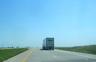
There have been a number of times that I felt that I was going to drive off the edge of the earth. Just looks like a road to nowhere.
There are passing cars to look at - or cars that I am passing.
There are quite a few Wind Farms in Kansas - these are the huge turbines and they were not moving very much.
And there are trucks that pass, or, more likely, that I pass.
There are occasional clumps of cottonwood trees growing in a streambed
I had just been thinking about Ruth McDowell when I saw this off ramp sign. Spooky.
This is my lap. I ought to put this picture on the refrigerator door. Or maybe on the wall over the bathroom scales. This was an accidental picture - made me laugh.
And then I arrived in Kansas City, MO, where the traffic signs are notoriously misleading. Especially trying to follow I-70 over the river.
That white arrow that points straight up is I-70 and I carefully lined up in the center lane. But the center lane divides and I divided the wrong way and ended up going north instead of east. So, I got off at the next exit, went under the highway, took the ramp going back the other direction. Over the bridge back into Kansas where I took the next off ramp and went over the highway and back on the onramp going east. This time I got in the right lane and made it onto I-70. I'm sure that most of you will be familiar with this exercise done somewhere in the world. I believe I did it once before, maybe in 2011 when I drove this route. I had not however, done it in rush hour traffic at 5:15pm. Not as bad as the 405 in Los Angeles, but bad enough.
There is Kansas City, MO, on the other side of the Missouri River. The traffic wasn't so bad until I got on the other side of downtown, then it was stop and go almost to Independence, only 17 miles inside the Missouri border.
Tomorrow, Missouri and Illinois, maybe even Indiana. Just six days left
# # #
Tuesday, August 16, 2016
Road Trip to Maine - Highs and Lows 08-16-16
It was a gradual up, up, and up drive. I-70 follows the Colorado River which becomes smaller as the road goes higher into the mountains. I had forgotten how steep and winding the road is - steadily climbing it goes through several tunnels until it reaches the top at the Eisenhower - Johnson tunnel which is at a high altitude and is very long. I didn't take any pictures this time, but posted some to my blog when I drove I-70 the last time. I can't locate the tunnel pictures, but here is the link for my trip in 2011.
http://delquilts.blogspot.com/2011/05/on-road-grand-junction-to-denver-co-05.htmlThen over the top and down, down, down until one is just south of Denver and then, suddenly everything is flat as far as one can see.
I had an early dinner at a Subway in some little town just off the highway and drove until 5pm Mountain Time, so it was 6pm Central Time here in Colby, Kansas, at another HIE. It was 93F, but very dry, and inside my room I think it was about twenty degrees. I eventually had to turn on the heat to warm my hands so I could work at the computer. Now it is 11pm and I will just label the pictures and go to bed. Tomorrow on to Missouri.
This is the Colorado River, right up against the highway.
Occasionally white water rafts can be seen negotiating the rapids. There are two in this picture, one on the far left and one right in the middle of the image with a bush partially blocking them.
Sometimes the rapids are interspersed with calm water - a break in the terror.
And when the water is calm there are wonderful reflections.

On the other side of the road there are elevated roadways for the southbound traffic. It is a really narrow canyon.
Here is the entrance to one of the tunnels.
And the view inside.
And an "artsy" view as I came to the exit.
I tried to get a picture of the sunflowers blooming along the roadsides and in the median, but this is the best I could do. They do well right against the pavement because they get the water runoff.
Ski trails dominate the hills behind Vail and other ski resorts.
There is the tree line up at 12,000 Feet.
And down through the mountains until one hits bottom at.....
The east side of the Rockies. This is just past Denver looking north...
...and looking south.
And on and on....
...and on.
I pulled off the road at a ramp accessing Vona, CO, to use my cell phone. I couldn't hear for the road noise. Here was this abandoned house.
The pavement immediately turned into a dirt road.
And the usual acre of junked cars and trash.
And on and on.... including the road construction. Of course they do it in the summer, when else would there be sunshine and no snow.
# # #
Mostly Monotony on a Monday 08-15-16
There is a problem with the Internet connection here and I have typed this post twice before. Each time it gets a bit shorter and less spontaneous and then it disappears. This time I am writing at 6:30am Mountain Time. If this doesn't take I might have to find a Starbuck's along the way.
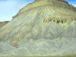
Lots of these towering "sand piles" in this light color that looks like sand.
~~~~~~~~~~~~~~~~~~~~
Yes, this is the part of the trip which shows the wild and beautiful scenery of the West. But five hundred miles of it has gotten a bit ho-hum this trip. There are gorgeous cloud formations that create moving shadows on the land, unbelievable rock-scapes in almost all colors of the rainbow (heavy on beige and brown), and the hardy, sparse plant life of the desert. Not much traffic and fewer trucks then I expect4ed, Dozens of FedEx Ground trucks, many hauling three trailers - something that is not allowed in California. There were many times that I could not see another moving vehicle in all the vastness around me. The speed limit was 80mph for many of the miles and my statistics showed I averaged 74mph for the day and the gas mileage clocked in at 25.9mpg. I love the onboard computer that calculates all this for me. I've spent the night in Silt, Colorado, because there is a Holiday Inn Express here and many of you know how much I hunger for their hot cinnamon rolls in the morning. I expect to be somewhere in Kansas tonight. Here are just 9 photos taken over the miles.
Clouds come and go, I even had a sprinkle or two. Had to review the settings for my windshield wipers, it has been so long sine I used them.
Clouds getting darker - the guy on the right doesn't seem happy.
This was probably the core of something when this was hot rock ions ago. In Bryce Canyon they call them hoo-doos.
Sometimes the highway goes through impossible slots between the canyons and I wonder how they could build such smooth, easy-to-drive roadways.
Many places that seem flat reveal the road cuts that were necessary to grade the road.
Yes, there was construction along the way. This is near Yellow Cat, Utah (No Services). But I took the picture to show the prows of the mountains overlapping on the left.
Lots of these towering "sand piles" in this light color that looks like sand.
But it is solid rock with very thin streaks of sand.
Here is an "arty" shot with the foreground in shadow and the sun shining on the background. Those dark spots in the upper middle are plants growing on a precarious slope.
I'm off for Kansas!
# # #
Sunday, August 14, 2016
Road Trip to Maine - first day. 08-14-16
I drove onto the 91 Freeway about 9:30am. I had thought to leave earlier, but then remembered that if I drove for six hours I would arrive wherever I stopped just in time for the motel check-in time - usually about 3pm. So, I left the house at 9am and stopped for a latte and bacon/gouda sandwich at my local Starbuck's.
The drive is mostly desolate desert country and the traffic was light.
Before Las Vegas I looked for these towers which were being constructed the last time I drove this route. At the time I wondered if they were light collecting towers and I was right. It is a solar farm - acres of mirrors that reflect the sun light to the towers which magically turn the light into power and, I suppose, dump it onto the electric grid we hear so much about This is a magnified image.
And here are the towers at a normal distance, several miles from the highway.
Las Vegas art selectors have placed various sculptures, metal, I think, along the way, mostly at off and on ramps to the Interstate. These are metal cacti, but I also saw mountain sheep, lizards, and coyotes, also in metal.
It is unreal to drive through the barren desert and suddenly there are tall buildings. These on the southern end of the city give way to more desert.
And then the overpasses start. There are many of them providing access on either side of Interstate 15. The further one has the outline of a mountain ridge at the handrail level.
This is more of the view of "downtown" Las Vegas. I believe this is a six lane section.
Another view of the towering casinos. And then I am out of town and the desert starts again. The highway goes through the Virgin River canyon which I have always thought it must be like one were to drive along the bottom of the Grand Canyon.
I arrived in St. George, Utah, at 3:30pm Pacific Time. I decided to check into a motel and called to make a reservation at the Painted Pony where I have eaten in the past.
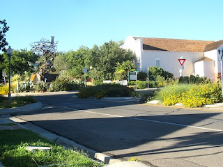
This is the area where the restaurant is located - a round-about with a tower in the middle.
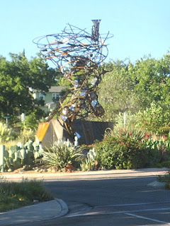
The tower is rusty metal and is located near where the rusted metal horse is. I showed it recently on my blog.
Seated at the Painted Pony. Very elegant and very pricey, but the food is fabulous. They are open for lunch Monday - Saturday and dinner every day from 4pm on.
For a starter I had the trout/potato cakes - flaked trout mixed with chopped up potatoes, wrapped in bacon and topped with a mustard sauce (which I set aside, it was too strong for the trout). I don't remember what the red sauce was, but it was tasty. The green is olive oil.
For a main course there was duck wrapped in bacon on a bed of mashed potatoes and a puree of celery root, topped with a very thin slice of apple and a celery sprig. The exact same thing I had the last time I was here. It is that good!
There was also chopped cooked apple mixed in with the duck.
I saved some of the duck for lunch tomorrow and topped off my dinner with bread pudding topped with banana slices and a sugar crust. On the plate was a little scoop of vanilla bean ice cream, it looks to me like a little bunny snuggled up to the pudding. I could hardly eat it.
As is was, I ate too much, even saving half the bread pudding for tomorrow, and drank a gallon of water which will probably cause me to be up half the night.
It has been very hot today, 109F in Baker (on their giant thermometer), 110F when I stopped for gas in South Las Vegas. And 108F when I arrived here in St. George. They are on Mountain time so it is now 10pm and I am going to bed. It has been a stressful and hard working few days. The price I pay for waiting to the last minute to get ready for a Road Trip. But it is grand to be "On the Road Again".
# # #
Subscribe to:
Comments (Atom)


