On Sunday I asked Dee Jacobs if she could take KoKo for a few days, and she said yes! So, I dropped him off with Dee on Tuesday morning and headed north to visit my friends Mary and Joe. And to drive into Pacific Grove to my most favorite quilt shop -
the fabulous Back Porch Fabrics.
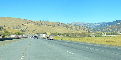
It is always hard to get out of the LA basin, crawling through the Pasadena area on the 210 is stressful and sometimes v-e-r-y slow. But once past Castaic the landscape is very bare and rather craggy.
There wasn't a lot of traffic on Tuesday and I made good time.
The hills have their tawny coloring and are very dry and susceptible to fires.
At this higher elevation it wasn't as hot as Placentia when I left there - 105F.
There is a ranch house amongst the trees.
Up and up with a cloudless sky and rolling hills. I think the high point is 3000 feet.
This is in the area of Frasier Park, the trees on the right in the distance are around a Highway Rest Stop, the last one I'll see for a while. .
Looking up at the tops of the hills. Sometimes there will be house at the very peak and I always wonder how the residents get up there.
After the top, the highway goes down through the area called the Grapevine, although it isn't as vine like as it was when I first drove it over 50 years ago. At the bottom of the downgrade is a wide spot in the road with gas stations and a motel that is called Grapevine.
Down, down, down, winding through the narrow slot in the hills.
There are two truck emergency escape routes where trucks that have lost their brakes can exit into a deep pit filled with gravel. The road bends upward and the combination of gravel and elevation help stop the truck.
I was hoping this picture would show the valley in the distance, between the two hills, but it is too hazy out there, it usually is.
That thing that looks like a flag in the middle of the picture is another sign showing the emergency exit. Beyond in the San Joacquin Valley.
Somewhere north of the Buttonwillow exit my odometer turned over to 200,000. I can't remember what the mileage was when I bought the Lexus used, but it seems to me it was about 30,000. I've driven a lot of miles!
After a night at Harris Ranch, I am still on I-5 North. Several spots showed where grass fires burned. I'm always sure that it was a lit cigarette that started these roadside disasters.
This one was quick put out on both sides of the road.
Just before Santa Nella, which is the largest town I come to since leaving the LA Basin, is the turnoff on CA 152 west toward the ocean.
It is mostly grassy hills with California live oak trees.
Down and down to the fertile valley where so much of our vegetables are grown.
Where turned off on CA 156, where they were, unfortunately repaving sections of the two lane road. They make it a one lane road where they are working, with a flagman to let so many cars go one way and then close that lane and divert the opposing cars into that lane. It was interminable. At one point I was stopped in front of this boxy house on the right side of the road. These people like to put statues in their yard, along with the junk, and even have a pair of plastic flamingoes on the right. There was also a pit bull to go with the chain link fence, but he wandered off before I could take the picture.
This is the view on the opposite side of the road from the house. All that dark loamy soil has recently been plowed. At the foot of the hills are farm buildings, farm workers and their vehicles. I believe the highest peak is Mt Fremont which is a California State Park.
I am with Mary and Joe tonight and will go on to Pacific Grove for a fabric fix tomorrow.
# # #


