I have driven this section of I-5 since it opened in the early 60s. The first time, there were signs saying, "Next gas 110 miles". Of course, some people didn't believe it, after all this is California, but they ran out of gas frequently. The highway was there, but not much supporting business because the roadway was through raw country and farmland. The convenience stores and gas stations and motels had not yet caught up with the times. Even now there are long stretches without services and it pays to keep an eye on the gas gauge. It is a long haul and the landscape varies only slightly as you roll along. Here is a series of pictures taken Tuesday, May 1st, as I drove south. Just to give you an idea what it is like to drive a portion the 360 miles from San Juan Bautista to Placentia, CA.
A lot of land is grazing for cattle, horses, and sheep.
Rolling over dales and hills. (No daffodils!)
Most of these pictures are pointing to the west. The mountains to the east are the Sierra and they could not be seen on this trip due to haze, which is not unusual, I rarely see them.
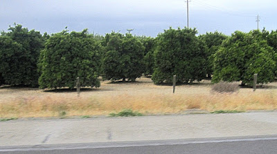
There are lots of orchards. I have shown you almond orchards which stretch for miles along the highway. These are citrus trees, notice how dense they are and the leaves are a dark matte green.
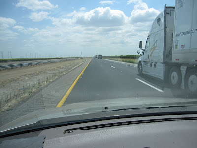
The road stretches on - mostly flat and rather straight (as roads go).
This image is to the east where the distant Sierra hides in the haze and clouds.
Again to the east with an orchard in mid distance.
Most of the west side of the highway is grazing land.
I didn't happen to catch any cows, but saw a lot of them.
Looking to the east there is one ranch/farm that has their vines covered with a sort of gauze. I imagine it is to protect the grapes from birds. I believe these would be table grapes.
Here is a slightly closer view of the gauze covered vineyard.
Since I-5 is the main north/south route there are LOTS of trucks. Mostly they travel in the right lane and the cars whiz past them in the left lane. Car speed limit is 70 mph, but the normal speed is about 80 mph. With a few exceptions who need to go as fast as their car will go, 100 if they can get by with it.
I'm just passing this truck.
And this little red car doesn't think I am going fast enough.
And this truck doesn't think he can stand to drive in the slow lane.
There are quite a few torn out orchards all along the way. The trees are knocked down and left in the field, I suppose they need to dry out.
These trees look like they have been down for a while, so they will probably be shredded soon.. I was unsuccessful in taking a picture of the piles of shredded trees and ultimately the enormous mountains of shreds/sawdust type stuff waiting to be hauled off somewhere. Probably used for mulch.
But then a few miles down the road there are new trees being planted. There is a huge problem of lack of water, but perhaps the new trees are planted with a more advanced irrigation system that doesn't use as much water. Don't know!
Toward the south end of my drive there is more uncultivated land covered with sage and tumble weed and native plants. When I first drove this route all those years ago it was mostly uncultivated.
There are two areas of feed lots. One is part of Harris Ranch near Coalinga and the other is further south.
The cattle are mostly in the open.
But one location has far reaching roofs with open sides.
After going up over the Grapevine part of the route I stopped at the Lebec Rest Stop. When I came out to return to my car it was sprinkling. Fortunately it wasn't anywhere near freezing.
Off with the sun glasses, on with the windshield wipers. I had to figure again out how they work. There has been so little rain in SCalifornia that I forget from year to year.
Higher and rainier.
Too little visibility for pictures now.
The rain continued to the top and down the other side into the Los Angeles basin. Not too far from the bottom of the mountains I ran into road construction at Magic Mountain. It was another 2-1/2 hours home.
It can be a long boring drive. You might want to take a book on tape!
# # #


